Forest River Conservation Area - Esker
The Forest River Conservation Area is a popular hiking trail in Marblehead, MA. On a visit to this hiking trail, you may come across some energetic hikers, dog walkers, or eager geologists! For while this Conservation area is a wonderful place to go and spend time in nature, it is also known for its interesting glacial features. The trail gradually slopes downhill, but surrounding this flat hiking trail are much steeper drops. The feature consists of soil and sand, and has lots of vegetations growing along the steep sides. The snake-like shape of this feature suggests that it is an esker. An esker is a deposit formed by the meltwaters from a glacier. Eskers form when a stream or river flowing underneath a glacier slows down, and deposits the sediments, which then form a backbone-like structure. Eskers are known as fluvio-glacial deposits, meaning that they were made by glacial melt-waters. The esker at the Forest River Conservation Area has fairly steep sides; the ground on either side of the esker averages at around 2-4 meters above sea level, while the top of the path is around 16 meters above sea level (Lockwood).
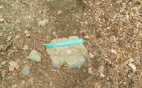
This image shows some of the materials that made up the esker. There are also some glacial striations on the rocks, which further support the history of past glacial activity.
The highest part of this esker is located to the southeast, while the ground surrounding it drops off suddenly to the southwest and northeast. These directions show that the melt-waters within the Laurentide Ice Sheet once ran from the northwest to the southeast. Also, the sediments began to clog the ice tunnel in the southeastern section of the Ice Sheet, because this area was where the majority of the sediment was built up.
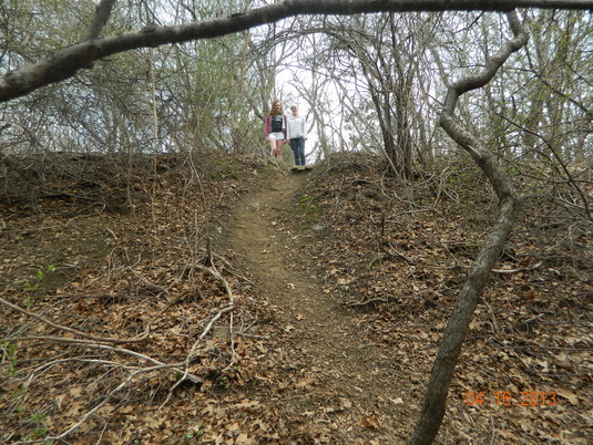
This picture shows the change in elevation from the base of the esker to the top (average change of 16m).
In addition, at the Forest River Conservation Area, there is a Kame Terrace, or an irregularly shaped small, domed hills that are made up of stratified dirt that was also carried by the melt-waters from a glacier. Like the eskers, these Kame Terraces are also examples of fluvio-glacial deposits (Lockwood).
Click Here to see more pictures of the Forest River Conservation Area.
